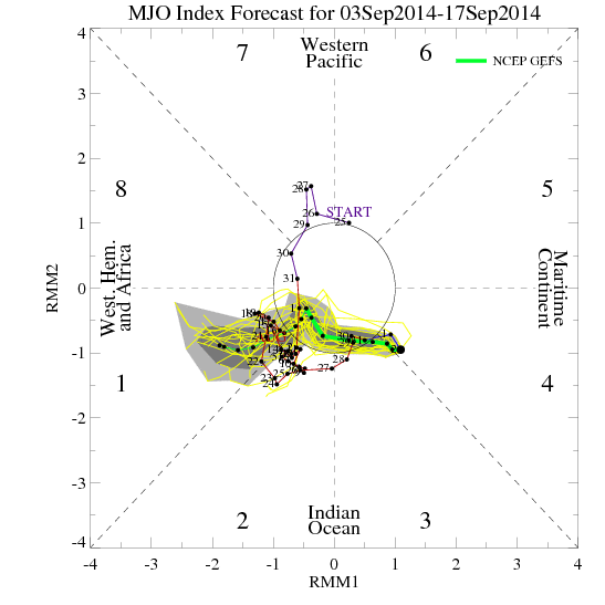
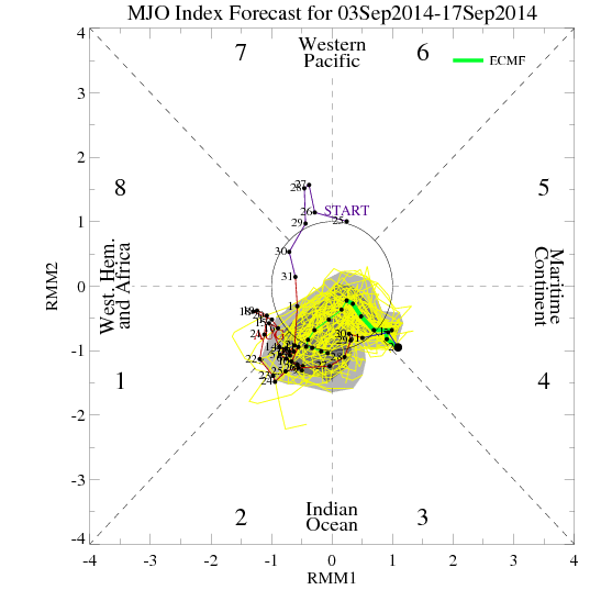
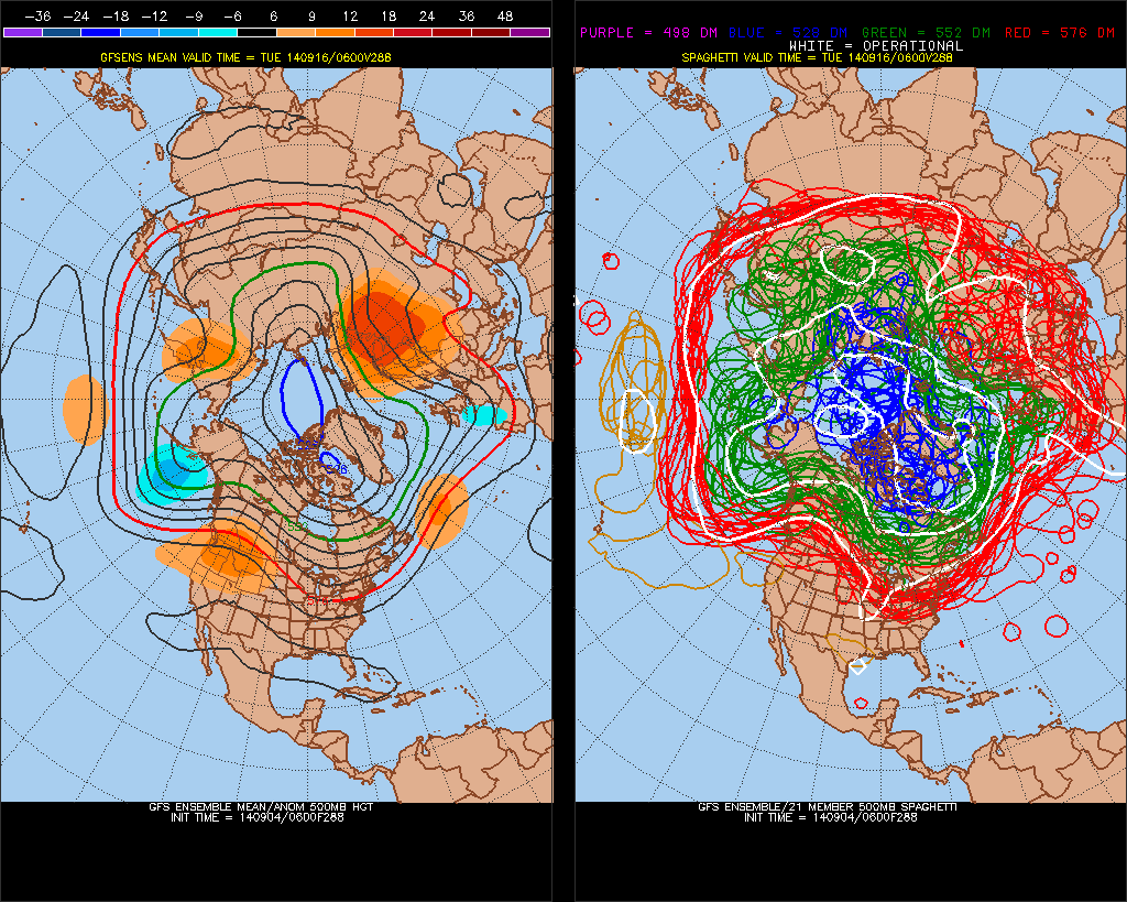
Currently the guidance has an incoherent or erratic MJO, next the 15 days or so. This has an influence on model and ensemble long-range 500mb forecasts for North America. We’ve see go back and forth between a strong ridge over the United States to not deeper trough. Until the MJO signal becomes more coherent or weakens to point where there will be little influence, we continue to see alot of volatility on guidance:
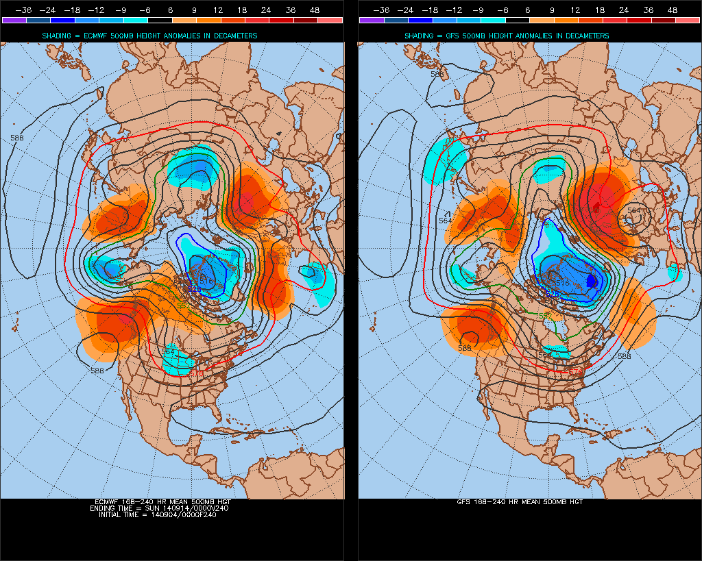
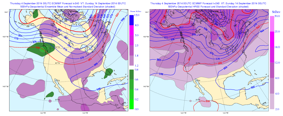
Overnight guidance looks unsettled next week, with a couple a waves of low pressure over the Mid-Atlantic states. If correct, this will have an influence on temperatures next week. Otherwise temperatures will start out near to slight below normal next week. Then trend above average later next week. Whether we same type of heat or large positive departures, we saw this week, remains to be seen. Long guidance overnight seems to be more pronounced with the trough over North America. But the GFS and it ensembles still faster bring the trough to the east than the Euro and it’s ensembles overall. The Euro still holds on to WAR and well above average for day or two before trough and cold front arrives Sept 13-14th. Their might be some GFS trough and Euro ridge bias at play here. So I’d be careful picking one guidance over the other right now, and look for consistency, trends first:
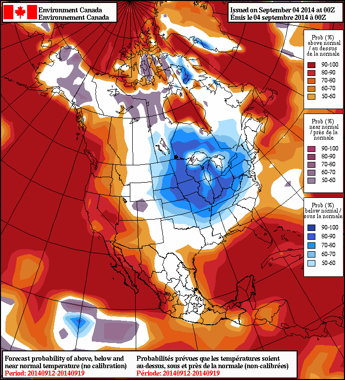
The NAFES 8 to 14 day outlooks shows high probabilities of below normal temperatures over Midwest, Great Lakes and Ohio Valley Lower probabilities for below normal temperatures further east. Probably due to strong Western Atlantic ridge keep cooler anomalies to the west. At this time, for the local tri-state area, I’m leaning towards temperatures fluctuating between slightly below normal to well above average and precipitation near normal, for the next 15 days at least. More updates this discussion may over the next couple days as more data comes in: