As I discussed previous post heavy rainfall is likely weekend. Particularity during Saturday night. Latest guidance is showing rainfall totals between 2″ – 3″ for much of the area. With locally heaver amounts between 3″-4″. Especially N&W of NYC.
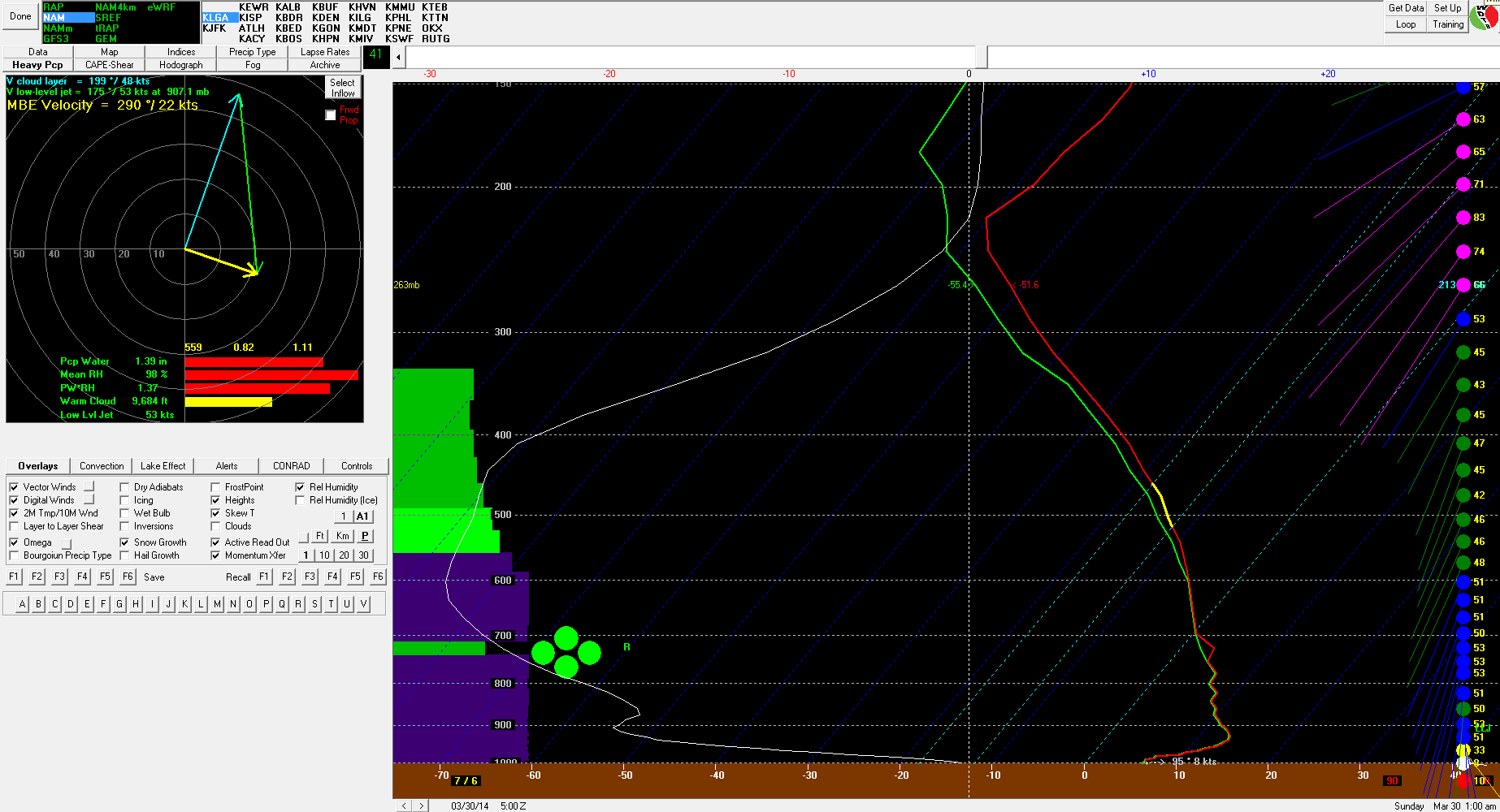
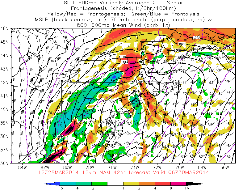
The 12z NAM today has area of very heavy rainfall moving through NJ, SE NY and CT between 7pm – 1am Saturday night. Bukfit sounding for LGA shows a 50-60kt LLJ, pwat near 1.35″ and a large of strong omega. There is also an area 600-800mb frontogenesis moving through the area tomorrow night. All this translates into strong lift and high moisture content over the area. Strong winds aloft are being prevent from reaching the due to strong inversion near the surface. However, downpours could bring down some portion of these winds down to the surface.
The 12z ECMWF is also showing a 50kt+ LLJ and moving pwats over 1.25″ – 1.50″ through tomorrow night. Another aspect of this storm that needs to be watch frontogentic forcing and elevated instability, behind the upper-level low Sunday afternoon and night.The 12z NAM shows enough dynamic cooling and cold air advection, for rain to change wet snow. Especially for inland areas. At this time, I am skeptical of this solution. But it’s not impossible to happen.
