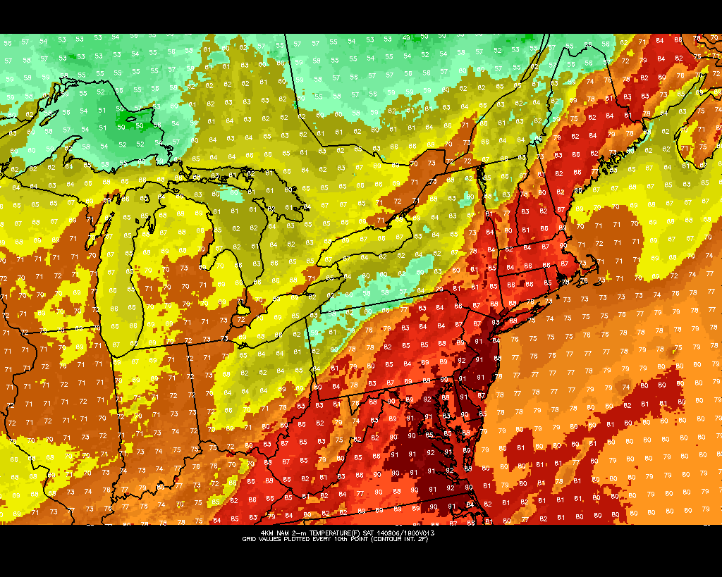
Yesterday south to southeast winds, transported a very muggy airmass into region. However, these winds off ocean, cause marine inversion with low clouds to develop. This kept atmosphere from mixing and less stable. Temperatures in the 80s across most of the Tri-state area. Today will be hot and humid as we much deeper westerly to southwesterly flow with 850mb temperatures near 18C this afternoon. This will likely allow for deeper mixing and temperatures to rise into the lower 90s, across much of New Jersey and into New York City. The only caveat here is that some convective debris from decaying showers and thunderstorms Western New York and Pennsylvania early this morning, works it east today. This could possibly keep high temperatures in the upper 80s. Closer to coast sea-breezes will develop this afternoon and keep high temperatures in middle to upper 80s.
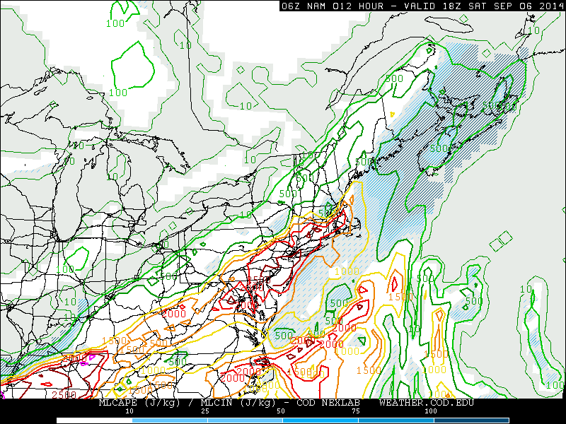
A pre-frontal trough developing over the area, will trigger some scattered showers and thunderstorms this afternoon and early this evening. These will form over interior areas for first then move southeast towards the coast. Latest NAM model guidance is showing 2000 – 3000 J/kg of MLCAPE, 20-25kts unidirectional 0-6km bulk shear, precipitable water values 1.5″ – 2.0″ ahead of this activity this afternoon, away from the shore. This is enough instability and moisture for thunderstorms to become strong or severe and produce very heavy rainfall in a short period of time. But shear is insufficient for thunderstorms to sustain their updrafts and organize into bow lines. At this time, I expect scattered thunderstorms to be pulsing up and down in intensity. Isolated damaging wind gusts and flash flooding in poor drainage areas will be the main threats. The Storm Prediction Center has already included much of the area in a 15% slight risk. So stay tuned for any severe thunderstorm watches this afternoon or evening.
 A cold front passing through the area, may trigger more showers and thunderstorms early tonight. However with the sun going down, instability will diminish. So these thunderstorms will be less capable of becoming severe. Behind this front is cooler and less humid airmass. Sunday will mostly sunny with high temperatures in the upper 70s to lower 80s. Monday and Tuesday will looking more questionable some model guidance showing a coastal low impacting the area with some rain and wind. Another post here will come later today on this system with new model data. 9/7 Update (that post will be delayed for model data today..)
