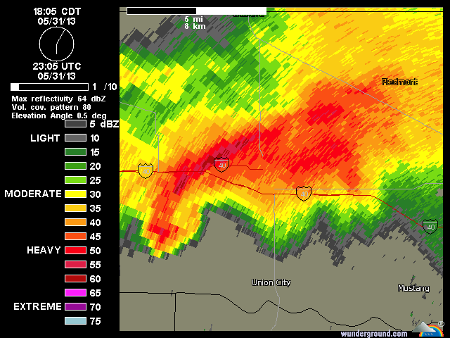
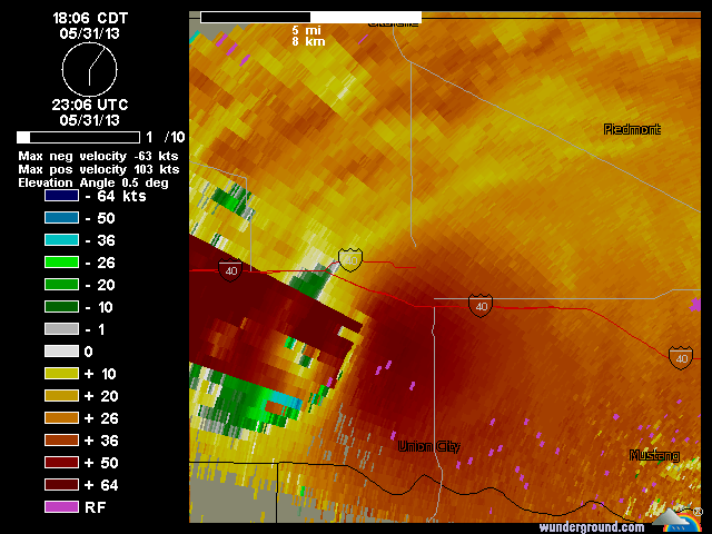
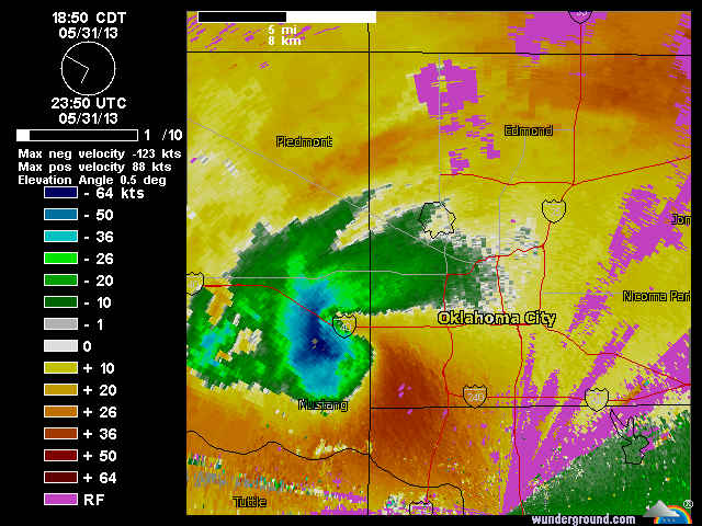
Here are some terminal radar images from weather underground, that caputured from the large tornado that was heading to the Oklahoma City Metro area yesterday. Base velocities were extremely impressive. Fortunately, it weakened before hitting the metro area.