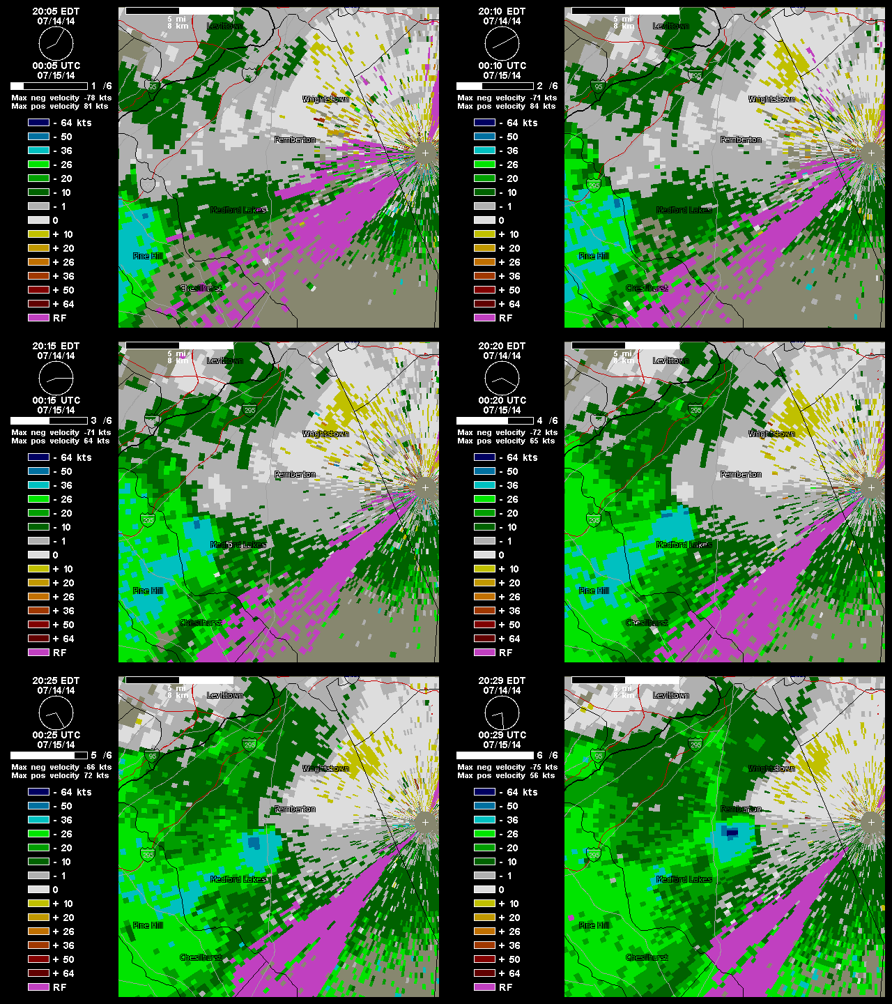
Yesterday t-storms produce mostly heavy rains with only some widely scattered reports of damage or strong winds. However, radar detected strong rotation and winds with thunderstorm over near Permberton,NJ last night around 8:30pm. A storm chaser on twitter took this picture of a possible tornado that hit near that town. A weak low forming yesterday over Southern NJ, enhanced low-level directional shear that may of produced tornado. The National Weather Service will likely go out and survey the area today. I may have another post about it, when the survey is completed. Update: NWS confirms straight-line winds. No tornado.

Meanwhile, the Storm Prediction Center has slight risk for the entire tri-state area again today. In my last post I discussed, that the severe weather threat may be reduced today with more showers and thunderstorms through the day, keeping instability lower. However, models still show moderate instability with SBCAPE values 1500 J/kg to 2500 J/kg and liifted Index values between -3 and -6, by this afternoon. 0-6km bulk shear is also 30kt to 40kts this afternoon. Those parameters support organized severe thunderstorms, in some locations. Especially over NYC, New Jersey, the Lower Hudson Valley . A southerly wind off the water, will likely keep parts of LI and South CT less unstable. Damaging winds from thunderstorms are still biggest severe weather threat. However, cold upper-level low a little closer to area to today, the threat for large hail is little higher than yesterday. Model soundings also indicate a backing of low-level flow this afternoon. So an isolated weak tornado cannot be ruled out.

The National Weather Service has also issued a flash flood watch for the entire area. Flooding still appears to be bigger threat than severe weather, as only marginal instability is needed for t-storms with heavy rainfall this afternoon and evening. With precipitable water values near 2.00″ any storm produce between 1″ – 3″ of rainfall in short period of time, resulting in flooding of poor drainage areas or small rivers and streams. Showers and thunderstorms will likely continue overnight and into Wednesday morning, as the cold front with system, slowly moves through the area. With the of loss diurnal heating, instability will diminish. So the threat for more severe thunderstorms will be over. But threat for heavy rainfall will continue. After the cold front passes, clouds will likely break for sunshine tomorrow afternoon. Sunshine, low humidity and seasonable temperatures are expected for Thursday and Friday.
[…] ← Possible Tornado in Southern NJ… More Flooding and Severe T-Storms Likely Today […]