Hurricane Season has relatively quiet so far. The main reason are that the subtropical high has been stronger parts of Central and Eastern Atlantic this year. This causes stronger easterly shear and more dust off Africa . Which inhibits more developing tropical waves moving Africa coast. Stronger high over East Atlantic, also allow more troughs or upper-level lows persist over Western Atlantic. Which cause more shear and dry air or tropical systems to recurve out to sea. This pattern continues as watch a few new systems in the Atlantic basin.
Tropical Storm Edouard (as seen above) has formed in Central Atlantic. As of the 5am ET advisory from the National Hurricane Center, Edouard is about 1325 miles east of Leeward Islands and moving west-northwest at 15mph. Maximum sustained winds are at 45mph. Currently the storm is encountering some moderate southwesterly shear. Which is restricting outflow on the western side. Slow strengthening still is expected over the next 5 days and it could become a hurricane. However it will pose no threat to land / All models are agreement that Edouard will turn north then northeast, between 50W and 60W. As deep trough moves into Eastern US and Western Atlantic early next week.
Another area of interest this morning, is a tropical disturbance labeled Invest 92L. Which is moving over Florida. Land interaction and some strong southwesterly shear now will inhibit further development until it moves over Gulf Mexico later tonight or tomorrow. The models eventually take 92L westward into Western or Central Gulf of Mexico over next 3-5 days. Upper-level winds on the models look favorable some slow development into a tropical depression or tropical storm. So areas along Western and Central Gulf coast should keep an eye on this disturbance.
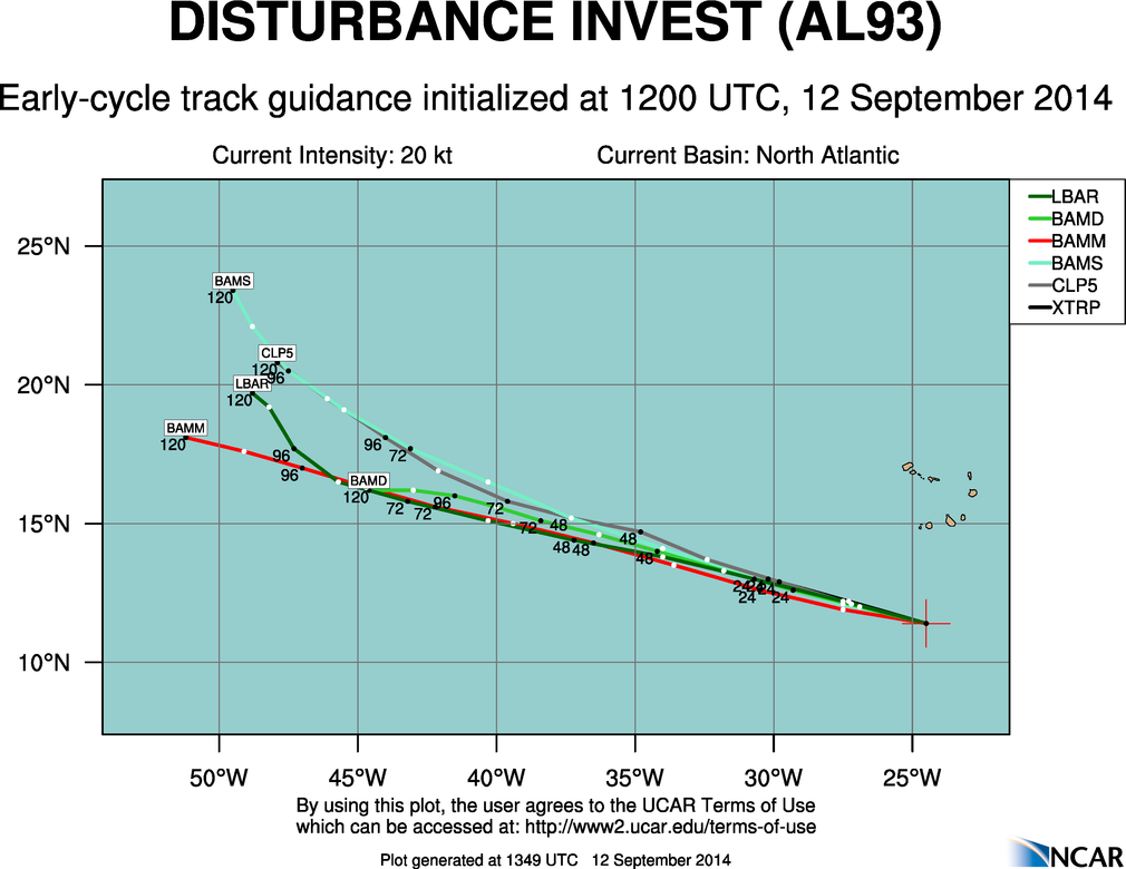
A tropical wave in Cape Verde has shown some signs of organization and been labeled as Invest 93L this morning. It’s too soon to say what the fate of this wave will be, with much confidence. But first generally have it tracking to west to northwest, over the next five days. Posing no threat to land.